
The high horizon identifies this sketch as a landscape. However, the sky in the top quarter of the panel is enough to weave some interesting meteorology in conjunction with the wave action on the lake. The brushwork is also reminiscent of that found in the previous entry "Tom Thomson's Petawawa Gorges; Night 1916" and it is logical to continue the tale of Tom Thomson's trail from where we left off. I can explain.
 |
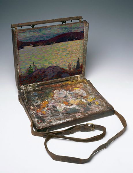
| Islands Canoe Lake, 1916 Height: 21.4 cm (8.4 in); width: 26.2 cm (10.3 in) Tom's Paintbox Size; McMichael Canadian Art Collection |
 |
| My map of Canoe Lake and the landforms in Tom's "Islands" tentatively identified. |

Now for the weather.. this story is all about gravity waves. I have written many times about how wind waves can be superimposed on swells but first some background physics. Consider "Keep an Open Mind", "Wind Waves and Swells and Lines in the Sky" and "Sunrise or Sunset - Seeing Even More Gravity Wave Clouds" for more background information although there are certainly more.
Wind waves are generated with the wind. Every wave starts as small ripples and a simple breeze which grow with time as the kinetic energy of the wind is transferred into the vertical oscillations which are gravity waves. The wavelength and amplitude of gravity waves increase directly with the wind speed.
Swells are longer wavelength gravity waves that propagate great distances from where they were generated by strong winds. During the course of their trip, the energy from the shorter wavelengths and higher frequency wind wave cascade to the longer wavelength and lower frequency swells. The wavelength of swells increases with distance from the source while the amplitude decreases relatively slowly. |
| Back lit large (long wavelength), alternating dark and light bands of clouds on the southern horizon are swells in the atmospheric ocean originating from strong jet stream winds far to the south |

If the wind waves turn anticyclonically with respect to that which generated the swells, the view is looking at the anticyclonic companion of the warm conveyor belt.
If the wind waves and swells are parallel, then the wind direction that created both are also parallel and the col of the deformation zone is overhead or you are closer to the source region for the swells.
I tried to explain all of this in the mid-1980s when I taught at the Training Branch for the then Atmospheric Environment Service. Placing this information within the atmospheric frame of reference was a challenging concept to understand - a tough sell so to speak and I could barely get past "sun glint". I was restrained to the chalk board and hand waving to explain these concepts. PowerPoint did not exist then.
I have continued to refine and practice the delivery of this material over the decades. I even took it to COMET in Boulder, Colorado. Most of this frame of reference material is yet to be published but it is so very important to understand clouds within the atmospheric frame that shape the moisture patterns. The cloud shapes and the superimposition of wind waves on swells can tell you much about the weather.

Looking at Tom's painting, I tried to decipher how the smaller cloud elements and wind waves lined up with the larger, alternating dark and light swells. This effort was an attempt to discover which side of the deformation zone was approaching Canoe Lake using the technique described above. I could not convince myself definitively whether those wind waves curled cyclonically or anticyclonically relative to the swells. And remember, I am pretty gullible but could not be convinced.

 |
| Another Attempt at a 3D Graphic to explain this Vital Perspective of Frame of Reference. This view closely represents Tom's view on that afternoon in the autumn of 1916. The view mimics the earth-bound perspective of an approaching warm conveyor belt. In an actual situation, the drift of the wind waves will reveal which portion of the warm conveyor belt is approaching your position. The cyclonic companion will bring more weather initially but remember, eventually the entire conveyor belt conceptual model must pass to you east with the guiding jet stream. |
 |
| Islands, Canoe Lake 1916 |
It is important to note that the wave action seems unaffected by the shoreline. This implies that the winds were southerly. Otherwise, the high and rocky shore would certainly provide lee shelter from the winds had they been northerly in direction. Southerly surface winds under the warm conveyor belt further allow us to deduce that the cold conveyor belt was quite weak. In addition, the surface wind direction and speed of the cold conveyor belt can be used to conclude that the weather system was also rather weak and/or moving quickly with the jet stream. The weather with the approaching warm conveyor belt would come and go quickly. For those who are interested, I explained the science behind these deductions in "Weather Lessons for Everyone from the Cold Conveyor Belt Wizard".
Someone with imagination and science can certainly weave an interesting tale out of those brush strokes - but one can never be utterly confident that the story is absolutely true and not a work of science fiction. To be a hundred percent certain, I would have needed to be painting alongside Tom Thomson and watching how the wind waves drifted in the atmospheric frame of reference. That would have been fun!
After Tom's passing, "Islands, Canoe Lake" was fittingly acquired by his artist friend J.E.H. MacDonald of Thornhill. Jim's son, Thoreau inherited the sketch. You might recall that I used a quote from Thoreau as motivation to begin writing "Tom Thomson Was A Weatherman" many years ago. Thoreau MacDonald (1901-1989), wrote:
“Thomson’s work would be a fine study for some competent critic, but anyone attempting it should be familiar, not only with every phase of his work but with the country too, lakes, rivers, weather; have them in his bones … “
By descent, the art passed through several other hands before reaching those of Robert McMichael of Kleinburg. In 1966, the founders Robert and Signe McMichael gifted this painting to the McMichael Canadian Art Collection and ultimately the people of Canada.
Warmest regards and keep your paddle in the water,
Phil Chadwick
PS: Tom Thomson Was A Weatherman - Summary As of Now contains all of the entries to date.
PSS: The weather that Tom observed and painted occurs regularly in the atmospheric ocean. Here is the reality of the winter storm of February 23rd, 2023 approaching Singleton with the anticyclonic companion of the warm conveyor belt on the horizon.
 |
| Wednesday morning February 22nd, 2023 Watch for the drift of the wind waves and point your Coriolis fingers in that direction. Drifting contrails can be helpful as well. Tom did not have jet contrails to monitor the atmospheric frame of reference winds in his day. |
 |
| The corresponding cold conveyor belt was strong easterly with very chilly winds. As a result, one could deduce that the approaching low-pressure area was intense, slow-moving or both Winter Storm Warnings were hoisted and verified. |
No comments:
Post a Comment